Wednesday, October 31, 2007

Emergency Repair

Near Little Cumberland Island, GA
30 58.591N 081 25.416W

If you've read any books about cruising, you'll recall that the skipper should be prepared to repair anything and everything on an instant's notice. We had an example of that today.

Yesterday, I wrote that the transmission felt funny. Last night I checked the oil level in the transmission. It was fine. It hadn't gone down a drop since I first filled it, and the oil is as clean as new oil from the bottle.

This morning, we were heading south, sometimes under sail only, and sometimes with help of the engine. I started the engine one more time and it wouldn't go in to gear. Moving the control lever forward or back just made the engine rev. "OH NO!" I thought. My mind always jumps to the worst in such situations. I remembered a note in the Beta installation manual that said that if you did not install the control cable just right, that the clutch would wear out prematurely and that this would not
be covered by warranty.

Fortunately, we were in a position to continue sailing for some time without the engine. I pulled up the floor of the cockpit, and crawled down in there and started moving the throttle control lever back and forth. "Aha!" Good news. It was not the transmission, it was the control cable. I investigated further and found that the place where the cable was anchored near the control box, had loosened and that the cable was slipping back and forth making it ineffective. I had it fixed within 10
minutes. Tonight, I have to readjust it to balance the motion forward and reverse, but for now we're OK.

From the sound of the weather, we can't go offshore until at least Friday night, and perhaps not even then if that nasty tropical storm heads our way. However, the good news is that we'll have all day Friday to walk on Cumberland Island National Seashore. That walking tour has been on our wish list for some time.

Tuesday, October 30, 2007

Wahoo

The Wahoo River, GA
31-36.16N 081-12.84W

We're still very frustrated. On the ICW, the winds seem very managable (and of course the waves are zero). Yet the weather radio says there is still a gale blowing along the coast with very big waves. Even when we passed Saint Catherines Sound today very close to the ocean and exposed to the winds, conditions didn't seem bad. I very much want to disbelieve the weather reports and go out there to see for myself. But, sigh, engineers are trained to be prudent, never reckless, and that's in
my nature.

Therefore, we'll stay on the inside tomorrow also. We still have 70 miles to go on the ICW to reach Florida. The ICW through Georgia meanders 250 linear miles to transport you 90 miles as the crow flies. That's a big part of the frustration.

On the other hand, the salt marshes in Georgia are wonderful. We sailed all day long using only the jib. At one point it appeared that we were in a huge lake, the size of Lake Champlain. However, a closer look shows that the huge open area is almost all covered with marsh grass, and it is only crisscrossed by narrow creeks and rivers. The illusion was heightened today because it appeared that the onshore winds have blown so much water inland that we had only high tide and higher tide. Much
of the marsh grass showed only 3-4 inches above the surface of the water, it was nearly submerged. That state persisted for the entire day. I think this is what the TV news calls low-level-coastal-flooding. Never mind, the marshes and the unpopulated barrier islands mean that there are few or no man-made structures to get flooded. In fact, this is probably the most isolated area along the whole ICW. There are not even marinas nearby. Tonight, we are anchored in a remote spot, and there are
two 50+ foot motor yachts anchored here with us. Those type of yachts almost never anchor out, they go to marinas if possible.

Our Lowrance GPS cursor button broke today. I'll have to fix that. The engine transmission also felt funny so I'll check the oil level. I'm ashamed to say that I haven't checked that oil level since the engine was new. Shame on me.

Monday, October 29, 2007

Venerable Old Ladies

Wilmington Island, Georgia
No LL

As we passed through Norfolk a couple of weeks ago, we saw two notable sights, both involving very old ships.


Just south of Newark we passed by a ship breaking yard. This is a place where they bring old ships, and where they are reduced to shredded scrap metal. The ship you see in the picture above was just starting the breaking promise. Here name, visible on the stern, was the SS Empire State. From the proud name and from her nice white paint job, she was obviously an object of great pride. It just seems rather tragic to me to witness such a once proud ship meet such an ignominious end. If Hillary wins the next election, they might pass a bill to send old conservatives like me to the breaking yard.

The ship below is the NS Savannah. She is a unique and once famous ship. She was the first, and last, nuclear powered cargo ship. She was commissioned in the early 1960s, a period of unbounded optimism about the future of nuclear power. Unfortunately, she was a huge failure. She was retired and no second attempt was ever tried, as far as I know. We last saw NS Savannah on the James River anchored with the US reserve fleet. Now she has been moved to an active navy yard. No doubt they are doing some kind of work to keep her afloat. Her reactor components must still be radioactive and hazardous, so she can't be sunk or abandoned or broken up.


p.s. It's so frustrating. The picture below shows the conditions we can expect if we go offshore right now, and for the next week. It just sounds too uncomfortable; I'm afraid we're stuck on the inside for a while. Look at the wave heights (click on the picture to see it full size.)


Sunday, October 28, 2007

Twarted Again

Turners Creek, GA
N 32 00.776 W 080 59.329

Whew. There's a lot to tell about today; much of it having to do with seamanship.

We got to Charleston Harbor around 1630 and immediately departed to seaward. I had resolved to use the short cut. You see, there is a stone jetty in Charleston that runs out about 3 miles. Always before I had to fight wind and current to get out through that jetty. It seemed to take forever and I hated it.

Last year, I discovered on the chart a pair of red-green buoys that mark a shortcut exit from the harbor. They mark a spot between the shore and the jetty where one can exit in deep water. Then one continues in 15 feet of water for about 2 more miles before coming to really deep water. I planned to use this exit.

This time, it was low (very low) tide as we exited. There was a full moon last night leading to spring tides (extra high and extra low.) I noticed breakers on either side of the red-green shortcut buoys. That was OK, it meant that I had to navigate carefully. I passed through the exit and headed on the charted path of deepest water seaward. I was disturbed though to see more breaking waves two miles out. As we approached the line of breaking waves, the depth became much less than that charted on my chart and on my GPS chart plotter. We were supposed to have 15 feet. It went down to 10. Down to 8. I began passing through breaking waves. Down to 7 with only 200 feet to go to smooth water. Down to 6. That was too little. I did a 180 degree turn and we went back in to the exit, then out again between the jetty arms. We lost an hour or more on that false start. I guess I'll never try that short cut again; the shoaling and sand bars can change too quickly to chart.

When we got past the jetty and set sail, I rechecked the weather report. It had been saying 10-15 NW wind tonight, 15-20 tomorrow, then 20-25 for 4 more days. Perfect winds for a fast passage southward! Alas, when I rechecked they added the prase, "A gale warning may be needed. This is a significant marine event. Mariners take warning." Ay ay, that sounded ominous. Should we change our minds? Libby said, "No. They only said maybe and they've fooled us before."

Soon after leaving, I got a surprise phone call from Chris and June on Albion. They were on the ICW just south of Charleston. Too bad. If I'd known they were there, I would have gone that way to meet up with them.

Through the night the wind picked up and we started really flying. I had a double reefed main sail and a reefed jib yet we were still doing 7 to 8 knots. The waves weren't bad, although they were building. (p.s. I have an old fashioned jib with jiffy reefing points just like a mainsail.)

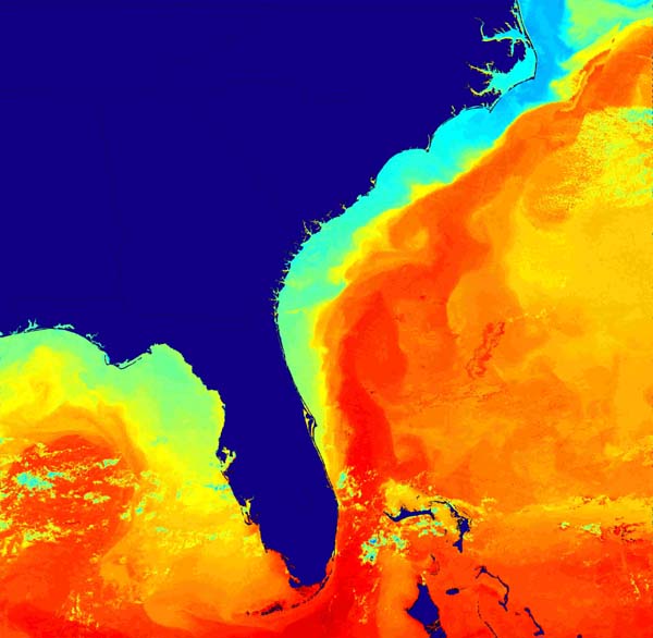
At 0700 this morning, I rechecked the weather. I knew that this report would be decisive. Either they would back off the maybe gale warning, or they would confirm it. When I turned the radio on I heard. "Gale along the Georgia Coast. Winds NW 30-35 with occasional gusts to 45, waves 8-13 feet. This is a dangerous event. Mariners should seek immediate refuge." That did it. I resolved to put in before the really bad weather hit.

Which inlet to put in to? Georgia has many. However, all but one of the inlets require a 3-5 mile approach to the NW. That would be nearly impossible for Tarwathie against a 30 knot NW wind. I've demonstrated before that I can't hold her nose to the wind under power with more than 30 knots of wind against us. If the tide were against us, it would be even harder. Fortunately, the Savannah River inlet was only 6 miles away, and it was the only one that didn't need a NW approach. We changed course for that.

I double checked on the paper chart for hazards. Good thing I did. I found a "submerged breakwater" directly in my path. Yikes! That would be unpleasant to hit by surprise. I altered course to miss that. On the other hand, the tide was 9.7 feet above minimum at that time and I probably could have gotten away with sailing over it. No thanks. We had another lucky advantage. We caught the end of the incoming tide and we had a 2.5 knot current helping us to get in. In no time at all, we were in the river and out of the ocean. After passing three container ships coming out (one of them named The Singapore Express, cool) we reached the ICW and turned south.

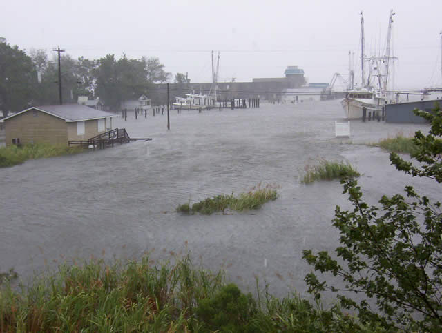
Tonight, we are at Hogan's Marina on Turner Creek. A marina is a good place to be when a gale blows. I remember from experience that anchoring here was difficult. 10 foot tides, 6 knot currents and 45 knot winds don't make it any easier, so this is one time I'm more than willing to pay the marina fee. Tomorrow, we'll check the weather again and see if we should depart. Turner Creek is a place originally recommended by June on Albion. It has a Publix market only 300 feet from the dock. That's the second closest supermarket to the water on the east coast.

I feel like a wus for chickening out on the gale. Some day we have to expand our horizons and ride out a gale or a storm while at sea. If we hadn't put in this morning, and just continued, we could have been in Florida by Sunday midnight, and all the way to Cape Canaveral by Tuesday morning. What a wasted opportunity.

I'm confident that Tarwathie is well up to the challenge. Three things hold me back. First, I worry about injuring Libby. She gets bad back pain after a period of hammering heavy waves. Second, my instinct tells me that we should have a crew of three when we meet that challenge. Libby and I are not enough. I need my sailing buddy Carmello. How about it Carmello; would you like to come down here and help me sail through a three day gale? I know that you'd be excited by the challenge.

The third thing is the scary language they use on the NOAA weather radio. I know that they exaggerate, they are overly cautious, and their triggers are too low. Still, the suggestive power of those warnings is strong indeed. It is likely that if I just looked at the raw numbers and did not hear their scary words, that I may have made the opposite decision.

Saturday, October 27, 2007

Inside Or Outisde

ICW, near Cape Roman
N 33 05.033 W 079 26.041

We really want to go on the outside, we're bored with motoring on the ICW. But the weather is not cooperating. The SE winds that we were hoping to get never materialized. Two days in a row we planned to go to sea, then canceled the plans. Now we hope to try again to go outside at Charleston tonight. There are strong NE winds forecast, maybe even too strong. If it sounds too much we may have to cancel again.

Anyhow, we're in the pretty stretch. We are in the middle of Cape Roman National Wildlife Refuge it is a beautiful and huge salt marsh with very little evidence of mankind. Last year when we passed through here, it was opening day of duck hunting season. Today there are no hunters around, but neither are there ducks.

Thursday, October 25, 2007

Foiled

Thoroughfare Creek, SC
N 33 30.735 W 079 08.747

I must be spoiled because I don't like having my plans foiled. (Come to think of it, that may be why I did well as a project manager.) I had planned on going to sea today, but the weather didn't turn out as expected. Therefore, we spent yet another day motoring down the ICW. Worse, now it looks like the winds won't shift until Saturday afternoon. Darn, I don't like having my plans foiled.

I know that many of my blogs sound like travel agency propaganda. We just go from one beautiful and fun spot to another and another. This is an exception. The ICW between Southport, NC, down through Myrtle Beach is ugly and unappealing. However, we're now past all of that, and in the midst of nature along the Waccamaw River. From here all the way out to the Wynah Bay Inlet, is nothing but nature.

We may just sit here at anchor until Saturday, or we may continue down the ICW. Last year we came in at Wnyah Bay to dodge a gale. As I remember it, the ICW was very nice until one gets within a few miles of Charlston, then it gets ugly again. Time will tell.

The power of Skipper Bob is amazing. We found this anchorage on Thoroughfare Creek in our copy of Skipper Bob's "Anchorages Along the Intracoastal Waterway." It is really remote and out of the way, and I didn't expect to find anyone. I was wrong. Skipper Bob's directions take us up the creeks and end with "anchor by the white sand bank." When we got here, we saw another boat anchored within 10 feet of the white sand bank.

There is a curiosity behind us. A section of the cypress swamp has been dredged to make a series of water streets. You know, like the ones in Fort. Lauderdale or Marco Island. They even appear on the nautical chart. However, there are no houses on any of the water streets. There is not even a road anywhere near that would lead to the development. It must have been someone's business dream that died.

Calabash

Calabash Creek, NC/SC border
N 33 52.376 W 078 34.198

Well, I told some people that we would skip South Carolina and Georgia on this trip south. Now reality is making a liar of me. We are anchored with our stern in North Carolina and the bow in South Carolina. The location is on Calabash Creek, near the Little River Inlet.

We had an easy day today moving down the ICW with a little bit of sail but mostly by motor. Starting in the afternoon, a series of thunderstorms passed by. We dodged two of them but we got rained on by one. It wasn't a severe storm though, and the rain felt good.

This was our first time along this stretch of the ICW. I must say that it's not very pretty. There are far too many houses lining both shores. I don't understand the people who pay so much money for these places. True they are on the waterfront, but they are packed in to very high density living, and they wipe out any trace of nature. The only good thing about it is that summer season is over and all the hundreds of jet skis we saw at the docks were sitting unused. I would hate to travel by
there on a holiday like July 4.

Our plan is to go to sea in the morning from the Little River Inlet and head south. The winds are forecast for SE and our course is SW, so it should work well. We'll also have four days in a row with these numerous showers. If things work well, we'll put in to Cumberland Island GA. That's a national wilderness area, and we heard that it's really nice.

After anchoring tonight, I looked at the boat next to us. It is Aruba II. Wow! That's the boat of our friend Andre. We first met Andre in Jacksonville, then we bumped in to him in Elizabeth City, then again a year later in the Great Dismal Swamp. Counting tonight, this is the fourth time we met Aruba II. The only trouble was that Andre was not in sight. A strange man wa on board. I called Andre on his cell phone to ask if his boat was stolen. He said no; his friend Roy is delivering the boat
to Florida for Andre. So after finishing the call to Andre I shouted out to the nearby boat, "HELLO ROY." Boy that surprised Roy. Good prank.

Tuesday, October 23, 2007

Tom and Cathy

The Provision Company, Southport NC
No LL

Well, it was another great day. Our plan was to stop in Carolina Beach to visit our friends Tom and Cathy. However, when we got there, we found that the state park marina has only 4.5 feet of water at low tide; not enough. We went back to see about anchoring in the Carolina Beach basin. But the houses surround the basin with such density that there would be no place to go ashore with the dinghy. Finally, we were forced to abandon that plan and to motor across the Cape Fear River to Southport. When we got here, one of the free docks at the Provision Company was open, so we took it.

Fortunately, Tom and Cathy were not daunted by the change in plan. They took the ferry across the river to meet us here. We had great fun, the four of us catching up on news from back home. Tom and Cathy are from Scotia where we used to live. We have many mutual friends. After getting the captains's tour of Tarwathie, they drove us to beautiful downtown Southport where Libby and Cathy did a bit of Christmas shopping. Then, best part of all, they treated us to dinner at the Provision Company.

Always before, when we visited Southport, the fabled Provision Company was always closed for the winter. This time we're earlier and they are still open. They lived up to their reputation; the food was delicious, and the atmosphere and the view were great.

Thank you Cathy and Tom for a great day. Please do fly down to meet us someplace in the Caribbean and we'll go sailing.

By the way, our decision to do an overnight sail from Beaufort to Wrightsville Beach was a good one. We had good and gentle winds and gentle waves the whole night. As the wind speed varied, we did as little as 3 knots and as many as 7 knots on a close reach. It was very enjoyable sailing. At the end, I even had to do something I rarely do. I loosened the sheets to spill wind from the sails to slow us down so that we didn't arrive at Masonboro Inlet before dawn. I would never attempt to enter a strange inlet in the dark. We did 70 miles in 12 hours, not bad.

Monday, October 22, 2007

Flat Rainbows

Adams Creek Canal
N 34 49.984 W 76 41.401

Last Friday we were sailing up the Neuse River towards New Bern. We were dodging thunderstorms the whole afternoon. These storms were very localized and very fast moving. A couple of times I scrambled to take down the sails thinking that we would be hit, but by the time the sails were down I looked again and the storm missed us. Finally we got hit by one. We doused the sails, dropped the anchor and went below to wait it out. It rained intensely, but only for about 10 minutes. Too bad for
the local people; they need rain badly.

Anyhow, after the storm passed the sun came out and we reemerged on deck. I looked to the west and there was a brilliant rainbow, but it seemed oddly flattened. I should have expected a rainbow with the sun shining just after rain had passed. For a while though I couldn't understand it's shape. The crest appeared to be very low in the sky and the two ends were plainly visible 2-3 miles apart. Finally, I understood. Never before had I seen a rainbow with the sun so high in the sky. Usually,
one sees rainbows only just before sunset. Then, the crest soars high in the sky and the ends of the rainbow are so far away that they can't be seen. You could never see a rainbow with the sun directly overhead, but if you could, it would appear to be a small circle of color surrounding your feet.

We were heading for Moorhead City today, resuming the southward trek. However, we're going to change our minds and go offshore for an overnight sail to Wrightsville Beach. The weather sounds favorable, and going on the outside will allow us to skip one of the most tedious stretches of the ICW.

We are not going on a straight passage to Florida yet. We have friends we would like to visit when we reach the Cape Fear River. Wednesday night, according the to forecast, sounds like a favorable time to leave Cape Fear, bound for Florida.

Sunday, October 21, 2007

A New Bern Day

New Bern, NC
N 35 06186 W 077 02.127

We were pleasantly surprised to see how many people we know were staying at the Sheraton Hotel Marina in New Bern. For many years it has been a favored place for cruisers who are more fond of the in-harbor life than the in-transit life. We too learned to like the in-harbor life in Marathon and in Vero Beach and many of the cruisers here are well familiar with both Marathon and Vero.

The key to the popularity here was the bargain rates for slips. Boats could rent a slip for $6.75/month per foot. That would amount to only $216/month for Tarwathie. For that very inexpensive rent, we would get an excellent quality slip, water, use of the Sheraton's facilities including free WiFi and a free newspaper in the morning.

The problem came from the money pressures caused by upscale retirement. A condo complex was built next door to the Sheraton and they sold many of the slips to them. Then, I presume Sheraton management figured out that they could earn a much higher return on investment by selling the slips outright than by renting them to boaters. Accordingly, they sent letters this month announcing shock price increases of 200% to 300%. Most of the cruisers who have been staying here for years are now seeking places elsewhere, or else deciding to cruise for a while.

Last night, we invited friends Hilde and Dave from SV Raven over for dinner. We met them last year here in New Bern. As we were finishing dinner Richard and Penny from SV Viking Rose stopped by to say hello. They came below and the six of us enjoyed some wine and swapped stories for a while.

After dinner, we played Balderdash with Dave and Hilde. They talked us in to staying here another day and invited us to a dock party on their boats tonight and to bring the Balderdash game with us. (Everyone we've tried that game on loves it.)


Yesterday morning I went for a walk in the waterside park. I went there to watch the finish of a marathon race in the park. Along the way I got mesmerized by something that only and engineer/fireman like myself could love. There was an enormous crane parked beside the park. The workers were engaged in replacing the secondary lifting cable. That cable appeared to be about 1.5 inches (4 cm) in diameter. It was huge. Not only that, but the mast of the crane was about 200 feet long. (See the picture.) To me, the interesting part was the problem of how to man handle that huge heavy cable in to place. I sat down and watched for 30 minutes.

Their solution was definetely low tech. They set up the cable spool under the lowered tip of the mast. Then they fed up the end over the block in the end. The key part was that one of the men clambered up on to the mast and pulled the cable down to the base. He had no sure footing while he was up there. He had to move from cross brace to brace. He had no safety line to prevent a fall. He must have been very strong. He pulled about 150 feet to the mid point of the mast. Then a second man climed to the tip and helped feed cable up and over the block. The first man continued until he had pulled that massive cable all the way back to the cab. I was very impressed.

The next problem was how to secure the cable to the motorized lifting drum? I was thinking about an eye splice or a swaged fitting. Nope, their solution was much simpler and more practical. They pushed the end of the cable in to a hole on the drum, then they put a wedge in to the hole beside the cable and drove the wedge home with a hammer. It was simple and practical.

Now you know what engineers do for kicks.

Saturday, October 20, 2007

How to Go South

New Bern, NC
No LL

We’ll be heading south soon for Florida, perhaps next week, if we get a good weather window. We prefer to do it by traveling “on the outside,” that means at sea. “On the inside,” means on the Intracoastal Waterway (ICW). The ICW in South Carolina and Georgia is not very interesting and there are a lot of problems with shoaling. Also, traveling on the outside is much faster. Roughly one day on the outside is equivalent to one week travel on the inside.

Last year we made it from Beaufort, NC to Fernandina Beach FL in 48 hours. If we get favorable winds this year we could do the same. If the winds remain good for 72 hours, we may stay outside all the way to Cape Canaveral.


Obviously, when traveling south, one avoids the Gulf Stream. So what does that mean? On the passage from North Carolina to Cape Canaveral, it means hugging the shore, never going more than 50 miles out. The small x dots on the following picture mark the north wall of the Gulf Stream on a recent day. Click on the picture to see it full scale.


Below is a much more beautiful, albeit less accurate picture showing the location of the Gulf Stream.

Friday, October 19, 2007

Sad News

New Bern, SC
No LL

We just arrived in New Bern. When I checked my email, I found the following sad message. I'm sure that many blog readers knew Fred Fearing personally and may care to send some words via Mr. Gray please do so by the 20th.

Good afternoon,

My name is Brian Gray, and I am an editor with the Daily Advance in Elizabeth City, NC. I am trying to contact cruisers on the intra-coastal waterway who knew Mr. Fred Fearing, who passed away this morning at 93 years old.

We are working on a story about him to run in the next few days, and if you have any statements regarding Mr. Fearing that you would like to share, please email by Oct. 20th.

Feel free to pass this on to any other cruisers who may have known him, and they are welcome to send a statement as well. Include your name, month and year you encountered Mr. Fearing if possible.

Here is a link to the article on our site:

Thank you!

Brian Gray

Special Content Editor

The Daily Advance

Elizabeth City, N.C. 27909

252-335-8089

bgray@coxnc.com


Here is a picture of Fred at a party in Fred's yard just last week.

Thursday, October 18, 2007

Scenes from Oriental

Oriental, NC
N35 01.492 W 076 41.741


We are at the public dock (upper right). At night, the nearby shrimp boats left their lights on all night (lower left). That makes a pretty picture but it is a conspicuous waste of energy. The Bean (lower right) is the name of the local coffee shop that is right across the street from the public dock. It seems to be the social epicenter of Oriental. This morning I was going to go there for a cup of coffee but it was so crowded at 0730 that there was standing room only.


Oriental is a unique place. It seems that many, if not most, of the people who live here are sailors and former cruisers. Annapolis may justifiably claim to be the sailing capitol of the east but Oriental deserves the claim to be the cruisers capitol. The local residents make daily pilgrimages to the water front to see what boats are there and to swap stories with the skipper and crew.


I overheard a young mother with two small kids chatting at The Bean yesterday. Someone asked how her new house was. She said, "Fine but right now all our time and energy is going in to fixing up our boat." Wow. I'm impressed.


Could we think about living here? I'm afraid that we couldn't afford it. Oriental has benefited from a real estate boom and the housing prices are sky high. Even a little house the size of a garage is likely to cost $500,000.


Compare the two harbor cam views above. The top one shows right now. You can see Tarwathie at the dock and you can see the back side of The Bean Coffee shop. The bottom picture shows the identical scene during Hurricane Isabel in 2003. That is a great illustration of a storm surge. The public dock where we are today was submerged 6 feet or more during the surge.

Wednesday, October 17, 2007

Monday, October 15, 2007

Scenes From Bath

Bath, NC
N 35 28.594 W 076 48.919


Bath, NC is a really special place. Both Libby and I love it. Not only is it historic and interesting, but it is tranquil and homey in a very pleasant way. We visited the 1734 church. We learned about Blackbeard the Pirate and about the show boat and Edna Ferber's novel Show Boat.


As we walk the streets of Bath we get the feeling that we could slip in to a timeless lifestyle in which nothing changes in a lifetime. No doubt this is a false impression, but it is very appealing. In other circumstances, I would find the idea of changelessness as repulsive, but not while I'm in Bath.


Bath local government satisfies my libertarian preferences. The town hall building is 15x20 feet. It is open Wednesdays and Fridays from 10:00 to 12:00. Behind the town hall is a gazebo (lust hus in Swedish) by the water where the town council meetings can be held.


I just learned how to collage photos before posting them. That's much easier. Did you know that you can click on the photos to see them full screen?

Fred Fearing and The Rose Buddies

Bath, NC
N 35 28.594 W 076 48.919


The Rose Buddies of Elizabeth City are famous among cruisers. They convinced the city to build free slips for cruisers. They personally welcome incoming boats to the slips, and they host a wine and cheese party for the cruisers every evening.

Fred Fearing is the first Rose Buddy and the best known. Fred is getting along in years and recently there have been no evening parties because he wasn't feeling good. Last week, Fred did host yet another party at his house. The picture above is Fred at that party.

Thank you Rose Buddies

Sunday, October 14, 2007

Guest post: Neverland's Scary Moment

Bath, NC
N 35 28.594 W 076 48.919

Today, I have a guest post from my friend David Wiencke. David owns the Westsail 32 Neverland. We met at the Crescent Boat Club last June. David gave me permission to post this story. I know that if it had been my story, it would have made my list for one of those moments you remember for a lifetime.

Let me tell you a story of our sail in Georgian Bay. First I must set the scene. Georgian Bay is about 120nm north to south with 30,000 islands (yes thirty thousand, no I didn't count them) all scattered within 2nm of the entire length of its eastern shore (think Milky Way). There are only a handful of marked entrance channels into this maze of islands if coming in from offshore. Also, scattered among all these islands are many reefs and rocks, too many to properly mark with nav. aids. Once in amongst the islands there is a well marked, yet torturous north-south "inside channel".


Of course, with "local knowledge" you can enter this area at numerous unmarked or less well marked locations. The water is very clear so one can see bottom at 20-30 feet in good conditions.


We found, from some local sailors, that our chart book didn't have a certain intermediate sized chart which showed several of the outside buoys marking some of the entrance channels. These local sailors showed us the location of a bouy to lead us into a marked channel, not on our chart, and save us several miles on our next leg. We sailed that leg without incident. In fact it was easier than expected, giving us confidence with navigating in this difficult area.


Our plan for the next leg was going to be a couple of short hops, but at the last minute we decided to take advantage of favorable winds before they changed, and sail it all in one day, about 60nm. We had to sail several miles offshore to avoid some unmarked reefs. The shoreline is rather low and there are no identifiable landmarks to confirm your position. I measured the lat./long. of two potential entrances and entered them into my trusty hand-held GPS. One route was well marked but 10nm longer, and the other shorter one, had no buoys (at least on our chart) to guide us in. The shorter one showed a promising finger of deep water going in towards the inner channel. It looked like it could/should have a buoy to guide us in. I also plugged in the lat/long of the nearest inside-channel buoy (off the more detailed chart) to the entrance.


The sun was getting low by the time we arrived off the shortcut entrance. If we sailed the long way we'd likely be feeling our way into harbor in the dark, so we decided to try the short cut. As we sailed in, following my GPS coordinates for the inside-channel buoy, we could see rocks, reefs and islands ahead and were trying to match what we were seeing with the chart. I was up on the bow with binoculars looking for any buoys. Then the depth sounder showed the bottom coming up fast, 20 ft, 12 ft. and I could see the bottom clearly now. I quickly doused the jib to slow us down. Water was breaking on the left and right and ahead. I could see some range markers and day markers on distant islands ahead, but couldn't find them on the chart. Unfortunately, we weren't anywhere near being lined up with the range markers. We found a passage between the breaking water on the reefs ahead (9' depth), but things were not looking like where we thought we were on the chart. Finally I spotted a red spar buoy ahead. We sailed near enough to read the number and found that we had come in 2mi. south of where we wanted, right through the reefs. Yikes. Turns out when entering the lat/long of the inside channel buoy I started entering the wrong one, caught the mistake, re-entered the correct one. Apparently some of the numbers of the mistake got into the corrected waypoint. I should have stopped to recheck when all my info didn't agree.

David Wiencke


Saturday, October 13, 2007

Tranquility Shattered

The Pamlico River
N 35 22.804 W 076 36.155

This morning we left early at 0700. We had anchored last night just outside the entrance to the Alligator River - Pungo River Canal, so as soon as we were under way we were in the canal. I let Libby sleep in and did it myself. I also rigged up my lines for steering from the foredeck again.

The scene was both beautiful and tranquil. I sat on a cushion on the cabin top while steering. It was chilly but I had a sweater on. Nevertheless, the sweater allowed cold breezes in so I was a bit chilly. Mists were rising out of the still water. When the sun came up, it began to warm me and it also cut off the rising mists. I began to feel like a cold blooded turtle warming himself in the sun while sitting on a log. There was no wind and the water in the canal made a perfect mirror surface.
I could see fish swimming from a long distance away because they made ripples on the surface. Since I was forward and away from the engine, I had quiet and I could hear the birds in the swamps that border the canal. I was reminded of the song, "Wouldn't It Be Finer Just To Be In Carolina In the Morning."

Just as I was setting up my camera to take some shots of the reflections of the forests in the water, a big power boat came roaring by. He caught me by surprise because when I steer from the foredeck I have no visibility behind me. This guy, with a home port of Ponce Inlet Florida was a big Chlorox bottle. That's what we call big power boats with acres of white gleaming fiberglass -- they resemble white Chlorox bottles. Sailors also call them stink pots for obvious reasons.

Anyhow, that boat shattered my tranquility. For the rest of the morning, the canal's surface never returned to the mirror surface I wanted. Why can't power boaters like that one just learn to relax and enjoy the journey.

That thought reminded me of a book I'm reading called The Happiness Hypothesis. It is mostly a book about psychology written by (surprise) a psychologist named Jonathan Haidt. It struck me how two things that this book says seem so directly applicable to our lives as sailing cruisers.

First, the book says that Buddha was right. Wealth and external things do not bring happiness. It is progress toward goals, that make us happy, not the attainment of the goal. The analogy of that is that it is not the destination but rather the journey that brings happiness. That's what sailors have always said about (some) power boaters.

Secondly, the book lists those external factors that seem to universally affect happiness positively or negatively. Among them is something the author calls flow. He said, "Csikszentmihalyi's big discovery is that there is a state many people value even more than chocolate after sex [hmmmm, never tried that] It is the state of total immersion in a task that is challenging yet closely matched to one's abilities." Wow! That sounds like what I enjoyed for so many years in my career. It sounds even
more like sailing. He goes on to say, "You get flash after flash of positive feeling with each turn negotiated, each high note correctly sung, or each brush stroke that falls in the right place. -- Pleasures must be both savored and varied." Yes, that's not only sailing, it is coastal or inland sailing, or the cruising life with epsisodes of sailing, and motoring, and anchoring, and going ashore.

In short, the book makes our cruising life sound like the best mental therapy imaginable. I won't dispute it.

Friday, October 12, 2007

A Tale of Two Museums

The Alligator River
N 35 49 W 076 02

We spent two days in Elizabeth City. As you know, The Hospitality City (River City it its other nickname) is the favorite stop for many cruisers. This is the first time though that it wasn't crowded with cruising boats. I think that most of the other cruisers are holding back to go to the Annapolis Boat Show.

We enjoyed southern cooking in Elizabeth City's restaurants. The Colonial Restaurant, and the Prime Sirloin Buffet Restaurant are among the best. We also went to a wine and cheese party at Fred Fearing's House. Fred is the first and foremost member of the Rose Buddies. Rose Buddies personally welcome cruisers to the city, and provide personal hospitality. Sam, the dock master, gives everyone detailed directions when docking. Fred, hosts a wine and cheese reception for the cruisers every day
at 16:30. Fred, who is 93 years old, has not been feeling well lately so there have not been parties for several months, but last night he had one. We wish Fred the best and hope that he's well enough to continue his parties for many years.

We also went to a scholarly lecture last night. Mr. Stephen B. Jareckie, gave a lecture and a slide show about the photo show "Ansel Adams In The East" Ansel Adams, the famous American photographer, is known for his pictures of Yosemite but he once made a trip on the ICW from Newark to Savannah that passed through the Great Dismal Swamp Canal and Elizabeth City. The photos of that trip are on tour and right now they are in Elizabeth City in the new Museum of the Abemarle.

The museum itself is the subject of a good story. It is an enormous and beautiful building, open only since last year. The first thing I noted about it was that at most times there were zero or only one car parked in the visitors parking lot, yet 15-20 cars parked in the employees parking lot. Nevertheless, Fred Fearing said that we should go and see the museum and we did.

Yesterday afternoon I went alone to the museum and I was shocked. Despite the millions of dollars worth of facilities, and the numerous friendly employees and guides around, there are almost no artifacts inside. They have a 1939 Coca Cola bottle, a 1916 Texaco gas pump, a 1950 school lunch box, and a cardboard box that once held plastic sandwich bags. They have a 12 foot moth sailing dinghy and a replica of a 20 foot fishing boat. Oh yes, they temporarily have the 50 5x5 Ansel Adams pictures
on loan. That's it. The overall impression is that this museum has an astronomically high budget for facilities, and for operating costs, but almost zero for exhibits.

Compare that to the museum we saw in Whitehall New York. That museum was jam packed with countless artifacts of all descriptions, many of them unique and interesting. Not only that, the museum was flooded a few years ago and they lost much of their inventory, so what we saw this year are newly collected antiques and artifacts. It is staffed by volunteers. It uses a donated second hand building. It appears to operate on a shoestring budget.

The contrast between these two museums could not be more drastic. If I were a taxpayer in Whitehall NY, I would be very proud and pleased and perhaps moved to volunteer myself, or to donate antiques. If I were a taxpayer in Elizabeth City, I would totally outraged and speechless over the pointless waste of my money.

Changing subjects. This morning it was windy and only 60 degrees. Brrrrrr. Too cold for us already. We're heading south. We got an announcement of a Seven Seas Cruising Association conference in Melbourne, FL on Nov 9-10-11. It sounds interesting and we think we might go for that. If we do, we would have to backtrack a little. We have reservations to fly from Jacksonville to Fairbanks on November 19. We would have to go north again from Melbourne to Jacksonville to do that. So be it.

Thursday, October 11, 2007

The Upper Posquotank River


Duckweed coats the lock walls


Our idyllic hideaway among the cyprus swamps.


A lilly pad city


A reflective sunset

Dismal Swamp Canal Pictures


It's impossible to feel like anything in life is hurried while you are on the Dismal Swamp Canal


Reflections

The canal covered by duckweed looks surreal


A close up of the duckweeds

When we got to Elizabeth City we heard that several other boats had severe trouble with the duckweed. Their engine cooling water intakes would suck it in and clog up their filters. They overheated and had to stop and clean the filters every few minutes. One boat had to ask to be towed. Other boats, like Tarwathie, apparently have intakes far enough below the surface that they didn't suck in any weed. I checked our filter and saw no trace of the duckweed.

Wednesday, October 10, 2007

Duckweed

Upper Posquotank River, NC
N 36 23.139 W 076 17.193

This morning we encountered a new experience. The canal was covered with a solid green blanket of duckweed. Duckweed is not an algae, but rather a small round leaf-like thing about 1/3 mm in diameter. Millions of these float on the surface of the water. Yesterday, there were a few light patches of duckweed in the canal. They looked like wind blown streaks of dust on a shiny floor.

Today, the duckweed was so thick as to form a continuous blanket over the water 1-2 mm thick. It made the canal appear to be quasi-solid rather than liquid. The appearance was surreal. Of course Tarwathie glided through the water with only imperceptibly increased resistance. Since duckweed floats, it did did not get sucked in to our cooling water intake to clog the filter.

The most noticeable effect of the blanket was to totally still any wind caused ripples in the water. Even when conditions are totally still and the surface of the water shines like a mirror, one can see patches of ripples in the distance caused by the stirring of wind currents. The duckweed covered canal by contrast made perhaps the most perfect large-scale flat surface I've ever seen. Of course, optical mirrors and semiconductor wafers are ground much more perfectly flat than this, but the canal's
flat surface extended for miles and miles. It conforms to the earth's surface but otherwise it is flat and level.

The surface tension of the duckweed covered water was obviously very high. It would take a very powerful current or wind to disturb the surface. It occurs to me that it would be nearly impossible to model or to calculate the tension of this surface from first principles, no matter how big a computer one had at one's disposal. It makes a good illustration that no matter how much we learn about nature and no matter how powerful our calculating tools, simple phenomena of nature surround us that defy
our ability to understand in detail.

I wonder how the duckweed affects the ecology. It blocks all sunlight from penetrating in to the water, and that must have a dramatic effect on the flora and fauna below. I notice also that even fall leaves dropping from the trees do not enter the water. Instead they sit on top of the duckweed and don't even get wet.

As we passed, Tarwathie left a wake behind her of water clear of duckweed. However, within 10 minutes of passing, the wake trail closed in and there was no trace left.

As we entered the lock I notice a number of hemispherical bulges in the surface, each about 1 inch in diameter. It appears that bubbles of methane from the muck on the bottom get trapped by the duckweed and can not burst on the surface. As the level of water dropped in the lock as we cycled through, the walls of the lock got covered in a thick coat of duckweed, perhaps as much as 1/2 inch thick.

We were only two boats cycling through the lock this morning. The lock master says that just now is typically the time of peak southern migration of the cruising boats, but so far, not this year. It's curious. Do they all know something that we don't know.

Attention cruisers: The lock master said that the canal is likely to be closed before the first of November because of lack of water.

We are anchored tonight in a wonderfully isolated place. Following a tip in a cruising guide, when the Dismal Swamp Canal met the Posquotank River we turned right instead of following the left turn for the Intracoastal Waterway. We followed the Upper Posquotank River through several bends about 1/2 mile away from the ICW. We saw a fisherman when we got here, but after that we had the whole place to ourselves.

This afternoon it was 96 degrees hot. Instead of sitting still, we got in the dinghy and went for a tour of the river and the swamp. The swamp was alien and beautiful. At least the plant life was beautiful. We saw some fish and some insects, but we saw no birds, no animals of any kind. The vegetation is tinder dry. That's remarkable considering that the ground is covered by swamp water.

Tonight, soon after dark, a flock of Canada geese flew over very low. They were following the river. That's the first flight of geese we've seen so far this fall. Cool.

Monday, October 08, 2007

(no subject)

North Carolina Welcome Center
N 36 30.390 W 076 21.349

It as a good choice to continue past Newark and Portsmouth yesterday. It was Sunday and the Jordan Bridge and Gilmerton Bridge opened for us right away with no delay. Also, we got to anchor in splendid isolation on the creek just outside the gates of the Dismal Swamp Canal lock. That also put us in perfect condition for the 0900 canal locking.

Passing through Newark we saw a beautiful tall ship tied up at Waterside Marina where we stayed before. The ship was The Liberdad from Argentina. She was quite a sight to see.

We appear to be ahead of the crowd for the southward migration. This morning, we were one of only two boats passing through the lock. In previous trips through here as many as twenty boats packed in to the lock and there were 4 lockings per day rather than two. When we got to this Welcome Center we were the only boat. On previous trips as many as 24 boats would tie up here, rafted 3 or 4 deep. This evening, one other boat pulled up to the Welcome Center, it was the only boat through the 1500
locking.

On the canal I pulled a trick that I used to do on our Tanzer 27. I rigged a line from the tiller to a snatch block clipped on to the lifeline. I ran the line up the starboard side to the bow, then down the port side, through another snatch block and tied the other end to the tiller also. Then, I was able to ride up in the bow and steer Tarwathie by tugging line one way or the other. It worked beautifully. When under power, this seems like the most rational way to steer. Visibility is much better
in the bow. Of course I woudn't do it in tight quarters or when there are a lot of other boats around, because I could steer but I was 25 feet away from the throttle controls.

Once on Sacandaga lake I pulled a good trick steering from the bow with this rig. I had slept on the boat overnight and on Sunday morning I was returning to the marina. I rigged my steering line as I described above. I also rigged my hammock between the mast and the forestay. That made it possible for me to steer while lying in the hammock; a very pleasant arrangement from my point of view. Libby wasn't with me, but my dog Pup was back in the cockpit. On the way back I heard some shouting and
saw men waving at me from a boat nearby that was being towed. I recognized them as fellow firemen from the West Charlton VFD. I diverted course to come closer to them and we chatted. I asked why they were being towed (their motor failed). They asked my how I trained the dog to steer the boat. Hee hee. That was fun.

Sunday, October 07, 2007

Steve and Susan

Norfolk Navy Yards
N 39 56.938 W 076 20.127

Last night we had dinner at the home of our old friends Steve and Susan. Steve worked with me at PTI going way back to the 1970s. Among other things, we were sailing buddies. On time I insulted his Aquarius 23 boat and the next day he traded it for a Tanzer 27. Many years later, I bought the Tanzer 27 from Steve. Now it sits in Oneida Lake, NY owned by my son John.

Around 1998, Steve and Susan moved from Schenectady to Williamsburg. Not a bad choice by the look of things. They have a lovely house in a nice development, right on the fairway of a golf course. Not surprisingly, Steve gave up sailing and took up golfing. As I look at their back yard, I imagine a little girl living there setting up a lemonade stand to sell cold drinks to the golfers.

Steve quit PTI long before I did, and he struck out on his own as an independent consultant. That's a gutsy thing for anyone to do who isn't close to retirement. One has to earn a living off one's wit without support of anyone or of any firm backing you up. Advertising is done by word of mouth and by one's reputation. Steve has done very well at that. Now, he says that he works only half time. Good for you Steve, you're an inspiration to all consultant wannabes.

Susan is a nurse, and she too has gotten to the consulting level and she travels extensively.

Last year, Steve and Susan flew to Fairbanks and went on an expedition up the Dawson Highway northward. I was up in that same neighborhood 2 years ago with my son David and grandson Bobby. We went camping for Thanksgiving.

Anyhow, we had a great evening catching up with Steve and Susan. Thanks for the invitation.

Today there is no wind so we're motoring for the whole day. It is my intention to sail past Norfolk and past all its bridges and anchor for the night near the entrance to the Great Dismal Swamp Canal. I learned that the canal is still open, despite the drought. However they only have lockings at 0900 and 1500. We'll get the 0900 locking tomorrow morning, then spend tomorrow night in the canal. By Tuesday we should arrive in Elizabeth City.

According the to Coast Guard, there was a 20 foot boat that sank and three people missing last night near the mouth of the York River. They have been searching for them all night and in to the morning. It's a surprise how often incidents like that seem to happen. I wonder if it is a cast of hoax distress calls. Last night was completely calm, visibility was good, and there is no particular reason why a boat and crew should disappear in the middle of the bay.

Friday, October 05, 2007

Dolphins Again

Near Yorktown, VA
N 37 15.341 W 76 28.644

Yesterday morning started with dense fog. We were planning to leave Urbanna early but the fog changed our minds. We eventually departed around noon. There was a good breeze and a few whitecaps, but the wind was exactly on our nose so we had to motor to Deltaville for the night.

This morning was nicer. We left Deltaville around 08:00. We seem to have trouble with the channel in and out of that place. Two years ago we ran aground in that channel. It wasn't a navigation error but rather an extra low low tide that did us in. One year ago I nearly hit one of the channel day markers leaving the harbor. Mary Ann rescued me from that. This morning, Libby almost hit the same channel marker. I yelled "TURN LEFT," she did and we narrowly missed it. It must be a jinx place
for Tarwathie.

The nice part was that after motoring out the channel a little bit, we were able to set sail and sail all the way down here to Yorktown. The winds were light so we didn't set any speed records, but we did manage 4 to 5 knots much of the time. We even got to do the spinnaker.

Yorktown is a place that is not friendly to visit by boat. Yorktown is on the south shore of the York River. There is no place to anchor on the south shore. Therefore, we are on the north shore in Sarah Creek. We are also very close to the base of the York River bridge, but alas pedestrians are not allowed to walk over the bridge.

Tomorrow night we are going to dinner at Steve and Susan's house, but tomorrow during the day we want to see some of the historic sights in Yorktown. Perhaps the most practical way is to take to dingy 2 miles across the river.

We talked to Dave tonight. He was fuming about the national guard. They sent him back from Kuwait early to attend a course in Mississippi. But when he got there, the course roster was full. Then they were going to let him go home to Alaska, but no, his CO wants the whole unit to be there in formation when the governor visits. Therefore, he has to sit there for 10 days doing nothing. Dave's wife Cathy though is going to change his attitude. She is going to fly down from Alaska for a few days
just to welcome him home early. That's true love and I predict that it will change Dave's bad mood in a flash.

p.s. This morning we encountered a big pod of dolphins. About two dozen of them in the pod. They swam alongside us for a few seconds. We also began seeing pelicans. Those were the first dolphins and pelicans we've seen since last spring. Welcome back to southern waters.

Wednesday, October 03, 2007

Day Sail

Urbanna Harbor,
N 37 38.215 W 076 34.168

Today we were to host our friends Bud and Nan from West Charlton, and their son Thad and daughter in law Allie who live in Virginia. The drove about 80 miles to go on a day sail with us.

The day did not start well. It was raining as I awoke. The weather forecast yesterday said fair, with 10-15 knot windd. This morning, the forecast was changed to 5-10 knots wind and probably rainy. Uh Oh. I almost called to cancel but didn't.

As it turned out, the weather did improve and we did have a nice day sailing, although we never did see much wind. It was probably just as well because Allie had never been on a sailboat before, and she didn't get scared.

We even got to use the spinnaker for a while on the way back.

It was fun to see Bud and Nan again. It may be some time before we see them again.

Soon after they left to go home, I got a couple of cell phone calls. One with bad news and one with good news.

First came a call from my friend Gerry. He reported that our professor Hammam from Clarkson has taken another sudden turn for the worse. They want to send him to a nursing home, and he hates that idea. All that we can do is prey for him and hope for the best.

Next came a very welcome call from our son Cpl David. DAVE IS BACK FROM KUWAIT! DAVE IS BACK FROM KUWAIT! HOORAY! His unit is stopping in Mississippi for debriefing and/or training, so it will be some more weeks until he gets home to his family in Alaska, but he is back on USA soil. That is very very good news indeed.

Tuesday, October 02, 2007

Analemma

Urbanna Public Library
No LL


We're well used to the name Tarwathie by now. However, if I were to rename our boat, I think that Analemma would be an outstanding name for a cruising sailboat. Besides being musical and mysterious, it suggests things that migrate north and south with the seasons.

Two days ago we left Urbanna with the intent of visiting Tappahannock . That's as far north we could go on the Rappahannock River. From Tappahannock we planned to take a day cruise north to see the famous eagle nesting ground. However, as we started I read about the region in our gunkholer's cruising guide. It made the trip sound unappealing, so we changed our minds. Yes yes. I know that I should read the cruising guide before deciding to go somewhere.

For the rest of you who would like to see the eagles, it appears that the named
day cruise is the only way to see them.

We spent two days exploring the Corrotoman River and the area around Irvington, VA. The Chesapeake is really a jewel. We could spend a lifetime here exploring new places without repeating. Libby found an interesting river on the Eastern Shore that we may visit next.

Right now, we're waiting for our friends Bud and Nan from West Charlton. They're going to drive down here tomorrow to go for a day sail. They are visiting their son who lives up near Quantico.

p.s. When we left Urbanna two days ago, our friend Gary was sitting at the marina waving. When we returned today
, our friend Gary was sitting at the marina waving. They really ought to give him the job of marina dockmaster.