Saturday, June 29, 2013

Who is a Cruiser?

Rome, New York
43 13.101N 075 26.684 W

I was surprised and delighted to find a story about the cruising life on the front page of today's Washington Post.  Reading the article however, I learned that their definition of cruising differed very much from ours.   The article focused on those living aboard houseboats at The Gangplank Marina in Washington DC (we spend the whole month of June there in 2008, read about it here.).  It also featured a couple living on a Hatteras 53 in Key West who were trying to decide whether to use built-in furniture on the boat, or to use furniture from the furniture store.  It seems very different indeed, but there is still a sense of recognition and commonality of experience that we have with those people.

So where do we draw the line between who is a cruiser, and who isn't?  We don't.   As we have seen it, the term is loosely and liberally defined.  Boaters, cruisers, liveaboards, it all kind of blends together.  

The most egalitarian and relaxed culture we've seen is that in Marathon, in the Florida Keys.  There sailing cruiser, motor cruisers, circumnavigators, and live aboards all mingle freely and happily as peers for the most part.  There is a kind of pecking order of status, but the boundaries are not strict, nor do they matter as much as you think.  Here it is:

  1. Circumnavigators
  2. Full-time cruisers
  3. Part-time cruisers and first-time cruisers
  4. Live aboards

There are also former cruisers who now live on land, and yet-to-be cruisers or wannabes, and other categories I haven't thought of.  We don't need to rank them all.

For practical reasons, motor cruisers and sailing cruisers are partially segregated.  Motor yachts need to remain tethered to the short power cord almost always.  Sailboats prefer to be out at anchor or on a mooring.   Therefore the motor-motor and sail-sail bonds are stronger, but we love to socialize cross category whenever possible.

About the only ones we exclude from this society are fishermen and weekend day sailors who seldom sleep on board.   Cruisers seldom mingle with those.

Unfortunately, there is a second group with whom we mingle only a little.  I'm referring to those who succumb to what we call "Keys Disease"   Those who pickle themselves with nonstop intake of alcohol and tobacco 24x7.  But even that group we learn to know by first names, and once in a while we shoot the breeze with them.    The State of Florida doesn't like these people and they keep trying to pass laws to get rid of them.   We have all learned to never apply the term "live aboard" to ourselves, while in Florida because that is a targeted minority.   In other parts of the country, you can use "cruiser" or "live aboard" as synonyms.

By contrast, we found  very little community in the camp grounds this summer.   We met only one couple that we would like to contact later.   For the most part, we didn't even speak to neighboring campers more than "good morning."   My friend Walt assures me that there is a community of full-time RV owners very similar to boating cruisers, but we didn't meet them.

What is the biggest flaw of cruising?   Only one comes to mind.   We tire of boating-cruising-destinations-sea stories being the only topics of conversation.   We yearn for other topics; politics, religion, science.   Not bad though, only one flaw.  How about that?


Thursday, June 27, 2013

Withdrawal


Ontario

We are stopped in a McDonalds now, not because we are hungry, but because I fell naked without the Internet. McDonald's is the only place I know where I can count on free wifi.

Georgian Bay on Lake Huron is beautiful. It reminds us much of the famous Stockholm Archipelago, including clouds of mosquitoes.

We are finding Ontario so far to be very expensive. $43 for a tent campsite in a public park, compared to $5 in Wisconsin. $5.13 per gallon for gas instead of $3.49. Even here at McDonalds, a Mcdouble costs $1.39 versus $1. The exchange rate is 0.99 to 1.00 right now.


But we came here for natural beauty and we are finding it. Ontario has lots and lots of land area per person.
Add caption
Wonderful swimming, warm, clean, soft, silky

Killarny, Georgian Bay
Our Camp Site

Wednesday, June 26, 2013

Superior

Bay View, Michigan

46 27.018 N 084 46.744 W


What a pleasant surprise. Neither of us have ever seen Lake Superior before. But we located a campsite on recreation.gov right on the water. After setting up our tent in the mosquito infested site, we took our chairs down to the beach in front of us. It was a very nice sand beach with no mosquitoes!

Lake Superior is big. 350x160 miles (560x260 km). It is also too cold for swimming.

We saw our first true sunset of the trip. We could see the actual horizon.

We went to sleep listening to the gentle slapping of small waves on the beach. The sound was unlike ocean waves and very unlike running water. How pleasant.

Other than that, we found northern Wisconsin and Michigan boring. Mostly, we saw nothing more than the trees near the road. I think we are spoiled and jaded by our recent experiences in The West.

Today, we will cross into Canada for 2-3 days. We may or may not find Internet there.

Tuesday, June 25, 2013

In Your Face Geology

 En Route, Wisconsin

We are on the road again after a wonderful weekend with Sharon and Darrick.  Thank you so much Y-knot, we had a wonderful time.

Here is a subject, I've been holding back on:

When I was a lad in school, I was never interested in geology as something to study. Later in life also geology was not very interesting. But when we travel in the North American West geology is so much in your face that you can't ignore it. As you marvel at the natural wonders, you can't help wonder, "how did this come to be?"

For example, approaching San Diego from the east, you pass through California's Imperial Valley. Then suddenly you come to a swath of brilliant white sand and huge sand dunes. After after a few miles, the dunes and sand disappear behind you. How the heck...?

Next you come to a series of mountains that appear to be composed of 100% loose rubble and sand. The sides are very steep. How can they avoid being shaken nearly flat during earthquakes. What I expect is to see bald base rock at the summit of a mountain with rubble around the base. Indeed, most mountains are like that, but not all.

Speaking of summits, a lake in the Mohave Desert taught me something about the mountains in New York and Vermont. I was marveling over the fact that desert environment seemed to extend down the shores of this lake all the way to the surface. I expected a ring of green for at least a fewfeet from the surface because the capillary effect would suck the water up. Evidently the sandy soils of The West do not have the same capillary force as clay-like soils in The East. But then I thought about eastern mountains. The soil on the mountain sides can't suck the water up from the base, they must impede water from flowing down from above. Aha, I thought, that is probably why most of the mountain summits in The East are bald. At the very top, there is next no source of water seeping down from above. There is an are near the top that can not support plants.

We love thinking of theories to explain what we see. On highway 89 from Flagstaff, Arizona to Page,the road parallels a spectacular series of ridges. The area is known for volcanism and earthquakes. I was always sure that these ridges were thrust faults. I tried to envision being there to seethe earth split during an earthquake, and seeing the ground on one side of the fault thrust upward relative to the other. But in the weeks following, we saw several similar looking features. One of them was described as being formed by erosion. That casts doubt on our amateur geology theories for everything. Being right is not the point, having fun speculating is the point.

The same thing happened at Capitol Hill, near The Waterbreak Fold. Looking at the angle of exposed layers of rock we noticed some places with layers perpendicular to the cliffs, others more parallel. The angles didn't fit my theories. Finally, I realized that areas stretched by folding (the outside of the curves) might erode differently than those areas compressed (the inside of curves). Oh dear, it was much more complicated than I first thought.

Perhaps after this trip, we an find a good online video university course on geology. Other online university courses have been very enjoyable.

Sometime soon, I'll post a special photo essay on the geology we saw.

As I expect, bare bedrock on top and rubble on the bottom.  

Sunday, June 23, 2013

Midwest Hiatus

Menomonee Falls, Wisconsin
43 08.639 N 88 06.191 W

We are spending a few days visiting with dear friends Darrick and Sharon from the sailing vessel Y-Knot.  On Monday, we are taking the car to a mechanic to fix the first (and hopefully only) mechanical trouble we've had.

Below are a few recent pictures.

A seldom seen sight today.  Amish in Wisconsin plowing his field.
Somewhere in Iowa
Click to see full size.  Panorama of Badlands National Park.  Note the bare rock in the foreground, the green green wile prairie in the middle, and the thunderstorm in the background.
Oh My God, what is THAT!  Farm machines in Iowa are scary.
Ha ha, that looks like a house on the highway ahead.  Oh My God, it is!  Get off the road quickly.

Friday, June 21, 2013

Rain Rain Go Away

Wildcat Mountain, Wisconsin

43 42.030 N 90 34.341 W


The law of averages finally caught up with us. Since April we have been touring and camping and never got wet from rain. Today our luck ran out.

They forecast storms last night but they never came. I got up at 0530 and everything was dry. I made morning coffee and headed for the car. In the car, I can listen to the NPR morning news, and to check the Internet. I was five minutes into that when a real cloudburst started.

After 90 minutes, I put on my rain jacket, grabbed an umbrella and walked down the steep hill to our site to check on Libby. Well, Libby was OK and dry inside the tent, but I slipped opinion the mud on the hill. Now I'm not only wet, but 50% covered in mud on my whole back side from heels to head.

Oh we'll, we have no right to complain. Rain is part of outdoor living.


Wednesday, June 19, 2013

Fröken Ur

Somewhere in Iowa

All through this trip, we have been navigating with the aid of Gigi. Gigi is the name we gave to the female voice of the Google Maps GPS app. We hear her so much that we had to go e her a name. We thought first of e name Google Girl, then simply G G, which became Gigi.

We have grown to have great respect for Gigi. Her knowledge, and skillful directions are amazingly accurate and up-to-date. We also retain healthy skepticism, because once in a while Gigi is very wrong. It is no different than navigating a boat. The chart plotter tells us where to go, but our eyes and common sense are the final arbiters.

But Gigi has an annoying voice. One can argue that a GPS should have an annoying voice to capture your attention. Still,we wish she had a more soothing voice. I want her to sound like Fröken Ur.

I'll have to explain. In 1973 we were living in Sweden. The only TV was Swedish TV1 and TV2, and the only radio was P1, P2, and P3. On all those broadcasts, at the top of every hour, Fröken Ur's voice would announce the time. (Fröken Ur translates to Miss Clock). At 2300 when TV ceased Fröken Ur would tell us "Good night. Sleep well." She had a wonderfully soothing voice.

Many years later I was in San Francisco on business eating in a restaurant when I heard that voice. I pivoted and asked the lady behind me, "Fröken Ur?" Yes indeed it was her. She had moved from Sweden 25 years before and she had recorded those voice clips in.the 1950s.

Anyhow, I wish Google would offer a Fröken Ur option for the map app.


An Unexpected Find

Iowa

We were driving hour after hour on rural state road 9 through Iowa. It was fairly boring. Endless corn fields checkered with endless wheat fields. An hour of flat fields, followed by an hour of rolling fields. The only break was an occasional grain elevator. How boring.

Curious, I ran a Google Maps search on "museum" To my great surprise, it said 5 miles to Great Lakes Maritime Museum. Huh? That was a surprise. So we went there. Who could resist. What we found was an area with five lakes, resorts, restaurants, marinas, thousands of boats, an amusement park, and the museum. It turns out that Lake Okoboji areas are called The Iowa Great Lakes.

Now it all makes sense. Those farmers would be just as bored as we were. A change of scenery and a change of pace would be very successful in tat location. Apparently, Lake Okoboji has been successful for more that 100 years and continues to be so. More power to them.


p.s. We camped last night in Fort Defiance State Park.  It was so buggy and so poorly maintained tht it was awful.  To escape the campground in the evening, we went to  a movie.   No more Iowa state parks.

p.p.s. The corn in the fields is only 3-4 inches high.   I expect it to be waist high by this date, or as eye as an elephant's eye by the Fourth of July (in Oklahoma). We're the planting s extra late this year?    Do they get two crops per year?

Tuesday, June 18, 2013

Hexagonal Columns

We are in South Dakota or Minnesota right now, but I'm catching up on some stuff from Wyoming.


Regular readers know that I'm a technophile. At Devils Tower, I was most interested in the explanations of the formation of this splendid natural artifact.  The explanation they give is this.

Magma intruded into sedimentary rock far below the surface.  As the magma cooled, it shrunk.  The shrinkage caused stresses and cracks.  The cracks formed regular patterns resulting in columns.  These columns are mostly 6-sided but some are 5-sided or 7-sided.  They are up to 600 feet tall, making them the largest natural rock columns on earth.   In millions of years, the surrounding sedimentary rocks eroded away leaving Devils Tower standing naked and tall.   In the two pictures above, you see the perfect example.  One of the columns broke leaving the hexagonal underside exposed.  It is center on the top picture, and zoomed in on the second picture.

Here is me at our camp in Devils Tower

Depiction of the Indian legend version of formation of the tower.


Monday, June 17, 2013

Recent Pictures 2

I caught him napping by the road
Fighting Stallions by Korczak

Looking down at the prarie, Cave of WInds.  I could see herds of bison from up there.
In Cave of Winds National Park

Recent Pictures 1

My flash photos came out poor, so I photoed a post card.  Note the exquisite boxwork formations on the ceiling.
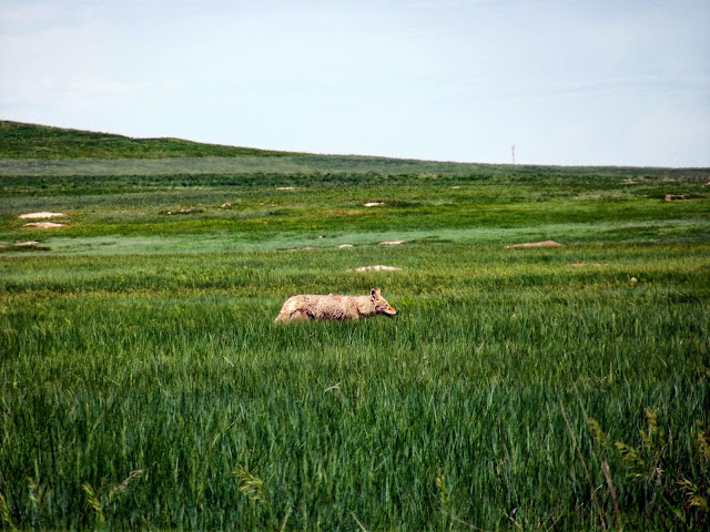
A wild wolf in the grass.  (We don't think it was a coyote)
Panorama, Badlands National Park.  Note the thunderstorm.
Go mow the lawn John.  The endless grass of the prarie.


Sunday, June 16, 2013

South Dakota Romp

Wall, South Dakota

43 59.665 N 102 14.47 W

We are doing very well finding B level national attractions. We skipped Mount Rushmore but found the nearby Cave of Winds. Saturday, we took the one hour guided tour of the cave.

The Cave of Winds has 120 miles of passages mapped so far. Experts estimate that is 5-10% of the total. It was a very fun, very different experience.

What was it like down there? It was a maze of twisty little passages, all alike. It was a little twisty maze of passages, all alike. It was a maze of little twisty passages, all alike. It was ... you get the idea.

My flash camera took poor pictures in the cave. The best I could do was to buy a post card and photograph that. Please forgive the poor quality of at picture too. Libby's iPad takes lousy pictures. Especially beautiful was the "boxwork" formations on the ceiling.


But the best part of Cave of Winds National Park was the prairie. Libby wanted a nap, so I explored alone. I found miles and miles of rolling hills covered with lunch green grass. There were also numerous bison (pictures later). This true prairie area is wonderful.

Today badlandsm and then on to a Corps of Engineers camp site at Lake Sharpe on the Missouri River.

Passing through Rapid City, SD, we saw signs for a free air and space museum, so we stopped. It wa Elmsford AFB. I thought it was very cool, and Libby tolerated because it is Father's Day. We saw a B1, a B52, Miniteman Missiles, Nike Missiles, and a Hound Dog nuclear cruise missile, plus assorted other nuclear weapons. I have a dramatic close up shot of The "Launch Key" from the minuteman battery. For those who don't know, minuteman missiles were retired about the time John and Jenny were born.

On the way to The Badlands, our map directed us to the tiny desert town of Wall. Surprise; when we got there we found an institution called Wall Drug. It is a tourist trap of the worst kind, but it manages to be absolutely charming despite itself. Read their story here, the story is almost as much fun as being there.


Saturday, June 15, 2013

Travel Note

By the way as we travel, we have been receiving news from back East. If we stuck to our normal cruising schedule this year, we would be somewhere on the New York State Canal System right now.

The news is that it has been raining in Biblical proportions in New York. Most of The Erie Canal and The Champlain Canal are closed due to high water.

Worse, there is another big rain storm heading for the Catskills this weekend. In preparation for that, the canal has removed the gates and is draining the canal and the river to make room for the anticipated flood of water that will come down Schoharie Creek. I got a notice from the canal corporation that any vessel between locks 8-15 might find themselves aground, or even high and dry temporarily. The temporary grounding would end suddenly when the flash flood from the creek arrives.

Yikes! Those conditions could sink a boat as seaworthy as a Westsail! We should be grateful that we are not there right now.


Crazy Horse

Black Hills National Forest

43 52.677 N 103 36.662 W

So, what dis we accomplish Friday? We found Spearfish Canyon that looks and feels much like New York's Adirondacks. We visited the mining museum in Lead City (ok but not great). We learned that state highways 135 and 16 heading toward Mount Rushmore are horrible tourist traps. We decided to skip Rushmore and Custer Park.

Finally, we visited the Crazy Horse Memorial. It was expensive to get in but the money was well spent. In fact, both of us think that the whole idea of the memorial (that native Americans have their own heroes and that they should be honored by all Americans) is excellent. Also, the execution of the idea is terrific. They eschew government money. And they attracted Korczak Ziolkowski, a very talented and prolific sculptor to make It his life's work. Today, Korozak's widow and 7 of their 10 children continue the work. In fact, it is hard to think of a more worthy cause to donate to.


My lands are where my people lie buried

- Crazy Horse


Friday, June 14, 2013

Devils Tower

Devils Tower, Wyoming

44 34.923 N 104 42.347 W


At the beginning of this trip, I hoped to see lots of small town Americana. As it turned out, we've seen move natural beauty and less human interest. But yesterday, we got a taste. We stopped in the city of Gillette, Wyoming for gas. Before leaving, I clicked on the "local attractions" button of Google Maps. It told me about The Rockpile Museum, close by.

We went to the museum (free admission) and it turned out to be a delight. It was chock full of artifacts of local interest. It reminded us of The Skenesborough Museum in Whitehall, NY that we are so fond of. Guns, saddles, mining equipment, a huge collection of spurs. Information about homesteading. We learned a lot about life on the prairie.

The engineer in me was greatly entertained by the Linotype machine, complete with a detailed step by step description of how it worked. I had no idea how sophisticated that mechanical monster was. But I clearly remember the bitter fights between newspapers and unions in the 60s and 70s as the Linotype machines were retired.

We try to avoid the most crowded tourist places, but we made an exception for Devils Tower. It was well worth it. The campground was very pleasant. We took the 1.3 mile trail around the base of the tower.

Beside the campground was a prairie dog city. We enjoyed that very much.

Lots of great pictures to post later.

Thursday, June 13, 2013

Plan A, No Plan B, C, D, ...

Buffalo, Wyoming
44 21.279 N 106 40.617 W

I get up at first light, which is 0430 around here.  Libby was up by 0600.  We took advantage of the early hour to take the nature trail nearby.  It was great fun.  It starts with a very shaky foot bridge (think of Indiana Jones).  Then we go trough a meadow, a conifer forest, a sagebrush environment, and a riparian environment back to the start.  We had fun and we still got to break camp by 0900.


Our plan was to drive to Thermopolis and to camp in the Hot Springs State Park there.  The drive up takes one through Wind River Canyon which is spectacular.  Thermopolis, what a name, but apt because it claims to have the world's largest natural hot springs.   We learned that the park did not allow camping and we failed to find any other camping place nearby.   Before leaving though, we took our 20 minutes in the mineral hot springs bath.  It was very relaxing.

Soaking in the hot spring bath

The next plan was to camp in Worland, but when we got there we couldn't find the camping area.

The third plan was to go to a National Forest Service camp ground in the Bighorn Mountains.   We got the GPS coordinates from the Internet.  The drive up took us through the charming little town of Tensleep, and up into another spectacular canyon, Tensleep Canyon.   But alas, when we got to the coordinates (8000 feet up) there was nothing.

Our fourth plan was to backtrack to a fish hatchery camp site we had passed near the base of the canyon.  But on the way there, some very threatening thunderstorms appeared so we changed our minds.

Tensleep Canyon


Plan five was to finish driving across the Bigfoot mountains and to find a motel in Buffalo.  We have no desire to camp out in thunderstorms.   That plan succeeded.

Look at that sky


By the way, watching TV news in the motel we saw emergency flash flood warnings and tornado warnings.  Camping in a tent, next to Tensleep Creek, at the bottom of a mountain would be a very bad thing to do when flash flood warnings are out.


Wednesday, June 12, 2013

Sinks Canyon

Sinks Canyon Park, Wyoming

42 44.914 N 108 48.575 W, 6414 feet altitude.

At first it seemed that Wyoming would be very boring in terms of scenery. Then we came to hills and the beauty returned. Rocky, snow covered mountains could be seen ahead.

We crossed the continental divide. We were surprised because we hadn't crossed The Rocky Mountains. Turns out, we stumbled upon South Pass where settlers followed The Oregon Trail. No big mountains for them to cross.

We took a dirt road 2 miles and found the mining ghost town of South Mills City. Lots of fun stuff to see there.

After that, the scenery turned spectacular. We saw rolling hills covered in green and big areas covered by yellow windflowers. In the valleys, outcrops of red rock contrasted nicely with the green. Soon we arrived at Sink Canyon and set up camp. We loved the camp site. Aspen trees, black dirt instead of red dust, and green grass. A roaring mountain stream was right behind us.

In Sinks Canyon, the Popo Agie River does something very strange. The whole river plunges into a hole in the rocks and disappears. It reappears, 400 meters down canyon, surfacing into a tranquil pool packed with enormous trout as big as a man's arm. (No fishing allowed). If the water stayed on the surface, it would have taken 30 seconds to travel that distance, but dye tests show that it takes two hours underground. They think that it travels through millions of tiny cracks in the rocks (natural fracking).

Augie
Augie
Wow wow wow, what a wonderful place.

Last night we met Augie, the camp ground host. He appeared to be Native American. Augie OSA cruiser like us, but instead of a boat he has an old school bus. Instead of exploring waters, he explores deserts. Augie is a free spirit, semi nomadic. He showed us so,e of the beautiful gem stones he had found. We had great fun discussing the merits of the simple life. We are a lot alike. Augie promised to come East some day and to come visit us on the boat.


the river goes in here
The river comes out here
The mountains up canyon.
 

Tuesday, June 11, 2013

Bad Choices

On Monday, we left Dinosaur National Monument heading north.  We were anxious to escape from the forecasted 100 degree heat. We chose Buckboard Crossing campground on the basis of altitude and location along our planned route.  In addition, the back road to get there promised be very scenic.

In less than 30 minutes were were mountains where the desert was replaced by aspen forests.

We passed by a half dozen or so wonderful mountain campsites.  "Never mind," we thought, "the one we chose will be just as nice."   Well when we got there, it was terrible.  The sites were exposed and the wind was blowing hard.  In fact is was blowing a dust cloud over the campsite.   The site was for boaters using the nearby Flaming Gorge Reservoir.  There were no trails and nothing to do without a boat. A sign announced a very strange complaint policy.  Libby said, "No go." so we moved on.  Oh, well you can't win them all.

Instead we are spending the night in a motel in Rock Springs.   Libby will do laundry and both of us can get hot showers.  Once a week for a motel is a reasonable compromise. 


Sailboats in the desert


Monday, June 10, 2013

The Quarry

Rock Springs, Wyoming

At first, we were disappointed by Dinosaur National Monument.   The Josie Basset homestead was neat, but the park seemed to have much less to see than other parks.   Out of boredom, we went to the visistor's center on our last day.   Usually the visitor's center is the least interesting thing about these parks.  Who wants to see a video about the nature rather than going outside to see it with your own eyes?   This time proved to be a major exception.

Here's the short form of the story.  Scientists excavated the fossil remains of over 500 dinosaurs from this tiny little quarry.  Many of them were amazingly intact.  Then they did something very smart.  They exposed the bottom layer of bones, but left them intact and in place in the rocks.  Then they built an air conditioned building where tourists can get up close and study them in detail.

We were absolutely amazed at the scope of the find and the number of bones.  We had no idea that anything like this existed anywhere on earth.   The one hour we spent looking at that rock wall made the whole trip to this site worth while.

The site was once at the bottom of a river.  Perhaps a deep hole in the river bed.  Bones and carcasses collected there.  They were  covered by sediment, fossilized, then the ground was lifted and tilted and the overburden eroded away.  Today, it sits almost vertical.


Sunday, June 09, 2013

The Squirrel


Dinosaur National Monument, Utah

40 25.141 N 109 14.624 W


Do you see the squirrel high up on the steep gravel slope in the picture? Neither do I. But I did see him there a few minutes ago and I had fun watching him for several minutes as he cavorted effortlessly up and down.

We easterners are used to seeing squirrels cavort effortlessly up and down trees, not hills. But I suppose there is no big difference. A tall tree or a steep hill are both likely to give protection against predators. I have a hard time visualizing a fox or a coyote on that steep part of the hill.

After a while I saw a second squirrel appear on the slope. "Aha," I thought, "a couple." But that wasn't the case, the second one turned out to be a chipmunk. The chipmunk was doing the same things as the squirrel. Anyhow, it is fun learning more about how different the environment is here.

P.s. this campsite offers us no shade. Yesterday afternoon it was 99 degrees here and the sun was so intense that it drove us away. We went to an air conditioned library until later in the day. Last night, the temperature went down to about 50.


Saturday, June 08, 2013

Adapting

Duchesse, Utah

40 10.212 N 110 20.631 W


We should average 100 miles per day for the next month or so. We are.earning that we need to change out habits to do so. We get up at 6, break camp and leave by 8. By 11 in the morning we have done our 100 miles, but that is much too early to stop. We prefer to continue for 5-6 more hours. We need to adapt.

There are boring plains regions ahead where the temptation is to drive past even faster.

One way to stretch it is to explore more small towns. When traveling, it is so easy to zing past towns without noticing. This morning, we explored Helper Utah. It was a very interesting place with mining, and railroad history, and a man street chock full of motorcycles from who knows where?

Another way is to stay several nights at places we especially like. We did that at Fruita in Capitol Reef Park. Today we are heading for Dinosaur National Monument.

We crossed one mountain range yesterday, and another today. Now, we see the western Rocky Mountains in the distance. Crossing the mountains is lots of fun. It also gives us the opportunity to choose campgrounds according to altitude. Too low and the temperatures are too hot. Too high and itis too cold. Yesterday. We made snowballs on the summit of Huntington Mountain.

Friday, June 07, 2013

Enough Brown & Red

Salina, Utah

38 55.964 N 111 48.824 W


It had been our plan to continue to Canyonlands National Park today. However, both Libby and I are saturated with views of deserts and sandstone, wether in towering cliffs or plunging canyons. It is time for a change of scene.

Studying the national map, we worked out a rough plan. We will go north through Utah, then Wyoming, South Dakota, Wisconsin, Minnesota, to Saul Saint Marie Michigan, then through Ontario to Georgian Bay, and Thiusand Islands New York. It ought to take a month or so.

We have already accomplished this change. Today we traveled past enormous irrigated valleys, then soft, rolling green mountains. Now, close to Salinas, Utah we see 11,000 foot mountainous peaks such as Mount Terrel. We will travel north toward, but not to, Provo Utah.

We will also restock supplies. We haven't seen a real store since Flagstaff.


Thursday, June 06, 2013

The Loop

Fruita, Utah

38 16.926 N 111 14.911 W


Just yesterday I wrote that the drive up here was the best. Just hours later we found more. U described beauty we hadn't seen before. It risks making me a liar.

What we did was to take the 125 mile long loop road around the park. About 40 of those miles were on washboard dirt roads.

Heretofore, we have been very cautious. I regret not braving the freezing waters to hike up to the end of the narrows in Zion. I regret not having hiked the 1500 feet up to the rim. We regret.not daring to take the alternative "Hell's Backbone" road 70 miles from Escalante to Boulder. We regret not taking the dotted line dirt road over the top of the Escalante Staircase. This time a ranger told me that our Ford sedan (which is not for off road) would make it OK over the dirt roads. Time to be adventurous. Off we went.

The path took us down the center of the Waterbreak Fold; a 100 plus mile long fold in the Earth. Sheer cliffs on both sides and relatively flat but moist and green land in the middle set the scene. How great was it? We took over 200 pictures in 125 miles, stopping the car each time. We felt so isolated that we feared that if the car broke down, nobody would find our bodies. But after a while we saw several other cars, so the isolation was illusory.

To get out of the fold, we climbed 1500 feet of switchbacks in less than a mile.

We did forego one thing, at the bottom of the loop is Muley Twist Canyon. It is so called because the mule team drivers said that the mules had to twist to get around the sharp bends. But the round trip hike was 10 miles long. In the heat and midday sun we weren't willing to risk it.

The car did OK except that the AC stopped working. Uh oh. But when we got back to thepaved highway it started working again. I guess the computer shut off the AC to prevent the engine from overheating at low speeds and steep hills.

Below is an arial shot of the Waterbreak Fold


Wednesday, June 05, 2013

The Big Day

Fruita, Utah

38 16.934 N 111 14.922 W

I'll let Libby cast her own vote for the best place in this summer's odyssey. In fact, I'll wait for the trip to be over before I ask her. But speaking for myself, I vote now for the drive from Escalante to and including Capitol Reef National Park.

It winds on the basis of variety. Route 12 is a windy, twisting, up and down highway. At every turn and every hill crest, a brand new scene is revealed to you, so beautiful that you say "wow" or "Oh my goodness" or in extreme cases "holy s..." Our camera shuts itself off after two minutes of inactivity. Yesterday it almost never shut off.

It starts with views of the Escalante Grand Staircase seen from the north, it is huge. Then we visited the Hole In The Rock heritage center and learned about that fantastic expedition. Then we came to the badlands. They exhibit the limitless colors and shapes of rock and desert in a parade of variety. Finally, you come over one more hill and the landscape is no longer bare rock, but sage brush. One more hill and suddenly you are looking down at a wonderfully lush green valley with the town of Boulder, UT. Then we drove up Boulder Mountain, past bristlecone pine forests to aspen forests. The aspen leaves had just budded and they were beautiful. Still higher, one comes to amazing lush mountain meadows where deer and elk graze. At the top, 10000+ feet, Libby was having trouble breathing. Because of that, we bypassed two beautiful campgrounds.

Down the other side of Boulder Mountain, and soon we were at Capitol Reef. Once again fantastic sandstone cliffs, but this time higher, steeper, and closer than seen before. The scenes are stunning.

We are camped in the park at a lovely little oasis called Fruita. It is a green place with two rivers where Mormon settlers grew fruit orchards. It is great. This morning at dawn I heard more song birds than I can remember ever before. We will stay here two,days.


Tuesday, June 04, 2013

Escalante

Escalante, Utah 
37 46.254 N 111 36.447 W, 5872 feet altitude

Yesterday was Libby's turn to get dehydrated (mine was back in El Centro, CA).   One thinks that one is drinking plenty, but perhaps not.  It sneaks up on you.   Anyhow, by yesterday noon, she was feeling really under, so we stopped and got a motel room.   (p.s. She feels better this morning.)

Where we stopped turned out to be a delightful place.  Escalante is a tiny town of about 1000 people.  It sits in the middle of fantastic scenery, surrounded by public lands both north and south.   The climate is nice and there is adequate water around.  The badlands region around here was the last uncharted area of the USA until 1870.

Escalante seems to survive mostly on the trade of people using this town as a jumping off point for back country adventures of one sort or another. Judging from the signs in the motel and around town, there must be oil drilling nearby also.  (Nobody wants the oil workers to try to wash their clothes using Escalante facilities).

Escalante was founded by Mormons in 1876.   It is very charming.   I wouldn't mind living here.   I don't think I would be bothered being a non-Mormon minority in a Mormon town.  All the Mormons I ever met were wonderful people that one would be proud to have as friends and neighbors.    But that's just speculation, the life afloat is our plan.

A clump of Mules Ears along the sidewalk

Nermo's is the only place in Escalante to eat.

The Escalnate Chamber of Commerce

Sunday, June 02, 2013

The Best is Yet to Come

Bryce Canyon, Utah

37 40.243 N 112 09.377 W, 7647 feet altitude


Riding in the car this morning I said, "The best is yet to come." She said, "How can anything be better than Zion?"

At Bryce, when she first saw those hoodoos, the beauty took her breath away. I said, "The best is yet to come." She said, "How can anything be better than Bryce?"

Tomorrow, and the next day we will drive highway 12 toward Capitol Reef Park. That is what I think is the best. I predict that Libby will say WOW at every turn and every hill crossing.

But any use of the word "best" is injudicious here in The West. There are countless "best" views. It is impossible to choose. It is also impossible to say you have seen them all. It's too vast.